Interested Article - A16 Mortar.jpg
- 2021-02-26
- 1
Размер этого предпросмотра:
.
Другие разрешения:
|
|
|
|
.
(2340 × 2369 пкс, размер файла: 1,02 Мб, MIME-тип: image/jpeg )
Краткое описание
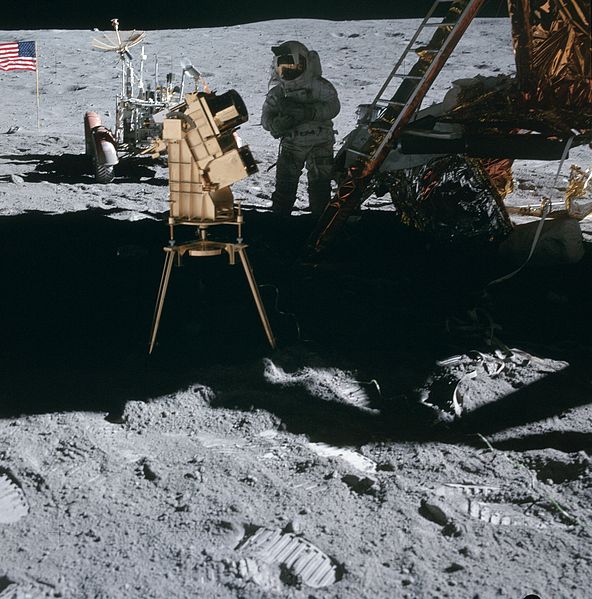
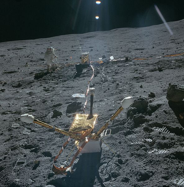
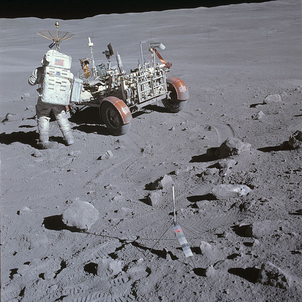
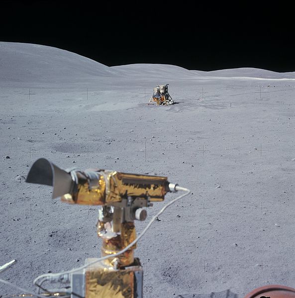
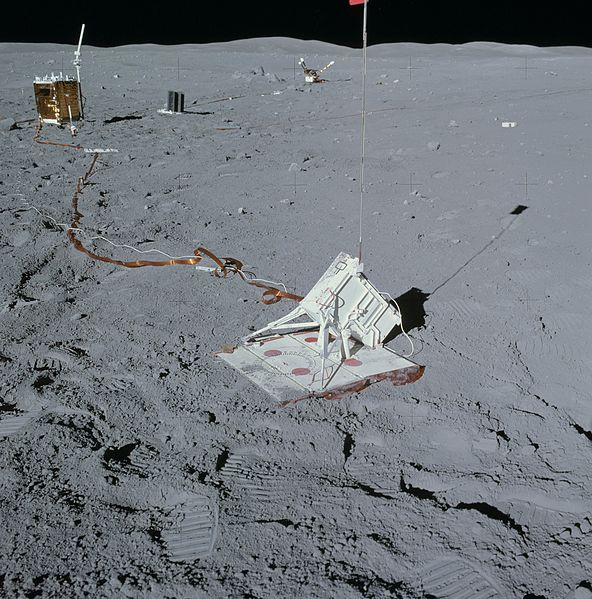
| Описание | View of the mortar pack from the southeast. After the astronauts left the Moon, experimenters on Earth sent signals to the mortar pack, via the radio aerial shown here, to launch each of the four grenades. Data from the four firings indicated that, underneath about 12 meters of regolith that covers the site, there is about 70 meters of low-sonic-velocity, poorly consolidated, impact debris on top of the high-velocity basement material. |
|---|---|
| Источник | |
| Время создания | 1972 |
| Автор или правообладатель | NASA |
Лицензирование

|
Это произведение является
общественным достоянием
, так как оно создано
Национальным управлением США по аэронавтике и исследованию космического пространства
.
См. также: {{ PD-USGov }} . Внимание! Об ограничениях в использовании данного шаблона-лицензии смотрите . |
|
История файла
Нажмите на дату/время, чтобы посмотреть файл, который был загружен в тот момент.
| Дата/время | Миниатюра | Размеры | Участник | Примечание | |
|---|---|---|---|---|---|
| текущий | 2340 × 2369 (1,02 Мб) | Igorvyh ( обсуждение | вклад ) | {{Изображение | Описание = View of the mortar pack from the southeast. After the astronauts left the Moon, experimenters on Earth sent signals to the mortar pack, via the radio aerial shown here, to launch each of the four gren… |
Вы не можете перезаписать этот файл.
Использование файла
Следующая страница использует этот файл:
- 2021-02-26
- 1